The geospatial world is changing fast. AI is reshaping how data is created and interpreted. New APIs are emerging across domains. And organizations everywhere are trying to modernize aging systems without breaking what already works.
In moments like these, it’s easy to talk about “standards.”
It’s much harder — and far more important — to make sure they actually work in practice.
That’s what an OGC Code Sprint is: a pressure-test of reality — a place where ideas become implementations, where assumptions meet code, and where gaps surface early enough to fix them.
OGC Code Sprints are where Standards stop being text on a page and start becoming tools people can actually use. They create space for implementers, editors, and curious newcomers to:
- Prove what works (and what doesn’t)
- Discover edge cases nobody anticipated
- Catch integration issues before they hit production
- Test emerging patterns against real-world code
- Build shared understanding and practical solutions
In a world racing toward connected systems, AI-ready infrastructure, and cross-domain data integration, these sprints are no longer “nice extras.”
They’re essential to building technology ecosystems we can trust.
An overview of the Rotterdam Code Sprint
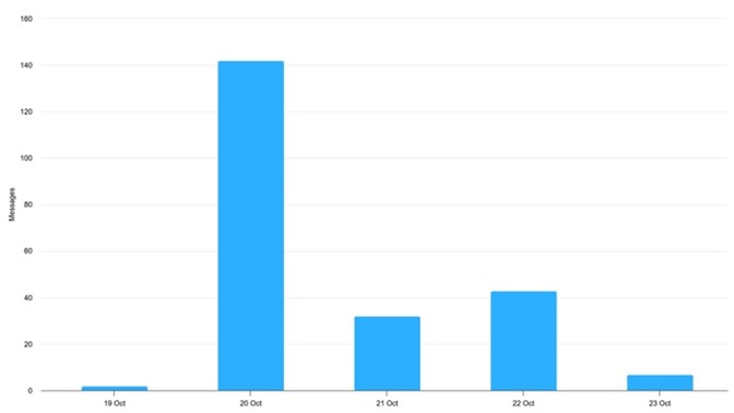
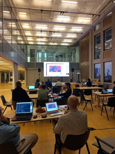
From 20-22 October 2025, the Open Geospatial Consortium (OGC) held a Code Sprint in Rotterdam, hosted by Geonovum and the Municipality of Rotterdam. The sprint took place at the iconic Timmerhuis building, a landmark of Dutch architecture, and the Vonk Innovation Centre, a hub for technology innovation in the city.

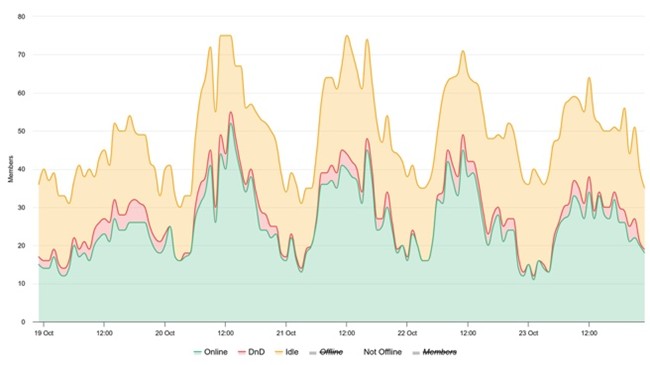
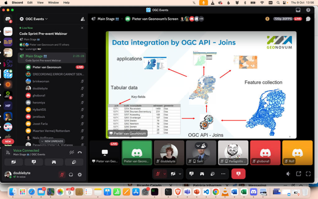
The sprint was hybrid, combining in person participation with the online component hosted on the OGC-Events Discord server. The server, which now has 983 members, sees activity peak during and around sprints, creating a vibrant space for collaboration between in person and remote participants.
Who were the sprinters?
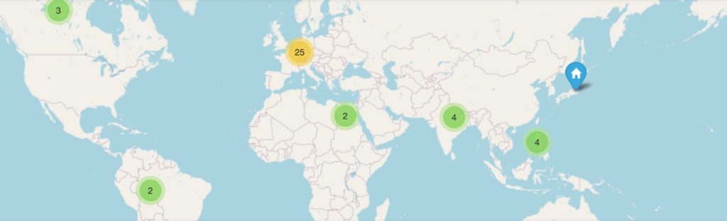
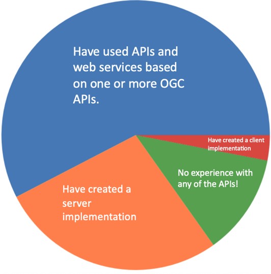
The Code Sprint participants joined from 17 different countries across different continents. Only a fraction attended in person, with a strong local presence from the Netherlands. It’s always nice to see a great participation from our hosts, as was the case this time.
It’s worth highlighting that being a coder is not a requirement for attending OGC Code Sprints. Many valuable contributions come from those engaging in no-code activities such as reporting issues, testing, and creating documentation.
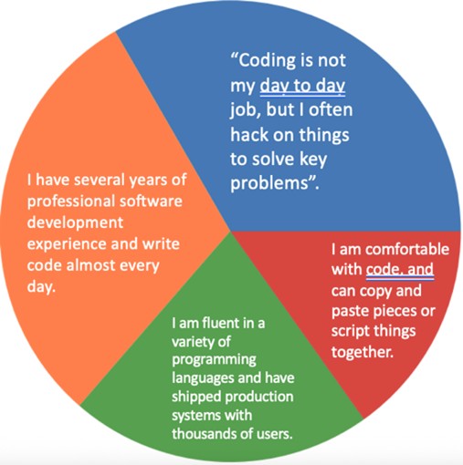
The sprint brought together a balance of seasoned developers and more product-oriented participants. Most attendees were already quite familiar with OGC Standards – though prior experience is never a requirement at all, and newcomers are always welcome.
How was the sprint structured?
The sprint was preceded by a pre-event webinar on October 9, which set the context by laying out the goals of the different Standards Working Groups (SWGs) and special tracks. Any SWG can register their interest in participating in the sprint, before the pre-event webinar.
At the Rotterdam sprint, we featured ten SWGs and two special tracks: Linters and Validators and DCAT-AP and OGC API – Records. For many participants, the preparation work began from this point.
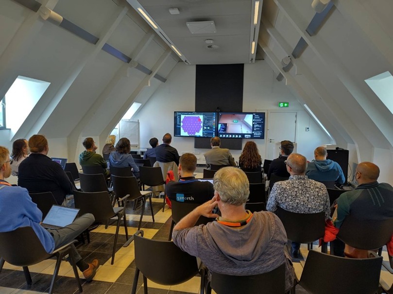
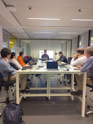
The first day opened with a kick-off session, after which participants organized into smaller working groups – some in person, and others online.
The group reconvened daily for brief backs and updates, and then then concluded with a demo session, where participants presented what they achieved. The complete scheduled can be viewed here.

The closing session also included a traditional Dutch tompouce cake, kindly offered by Geonovum’ s director.
Ad-hoc discussions
Four ad-hoc sessions were scheduled during the sprint to discuss specific topics of interest:
- JSON-FG discussion, bringing together SWG chairs and implementers.
- Content Negotiation by Profile discussion: touching multiple Standards.
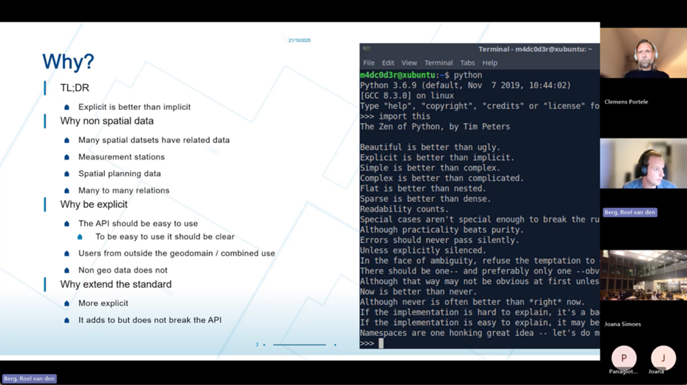
- Non-geospatial data in OGC API – Features: which led to an action to draft a best practice document.
- OGC API – Records session: focusing on Transactions and Harvesting.
These discussions were very useful, as they brought together different implementers, sometimes with different perspectives on the Standards. It was also very helpful to have members of one SWG attending the discussions of another, as they could find common points and sometimes suggest alternative places for a given requirement.
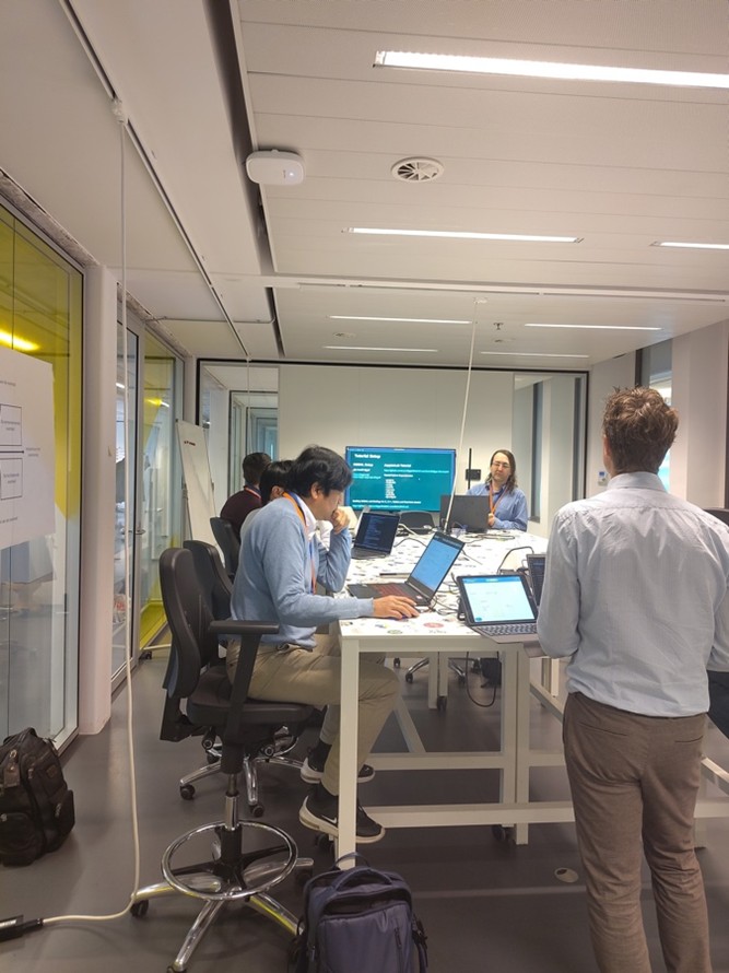
Onboarding day
The first day of the sprint also featured Onboarding Day, a parallel track for anyone wishing to learn about OGC Standards. The day began with an introduction and continued with a stream of five tutorials lasting around 45-60 minutes each.
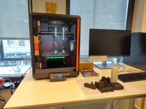
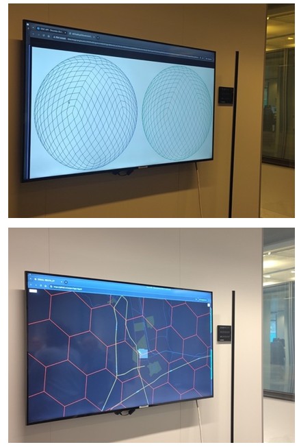
The first tutorial introduced DGGAL, a free and open source library that provides an interface to Discrete Global Grid Reference Systems (DGGRS). This tool supports implementations of OGC API – DGGS, and it provides bindings for different programming languages. During the tutorial, participants experimented with interacting with a DGGRS using the python bindings, which were quite easy to install. Inspired by this tutorial, one of the sprint participants went on to make use of this library in his final demo.
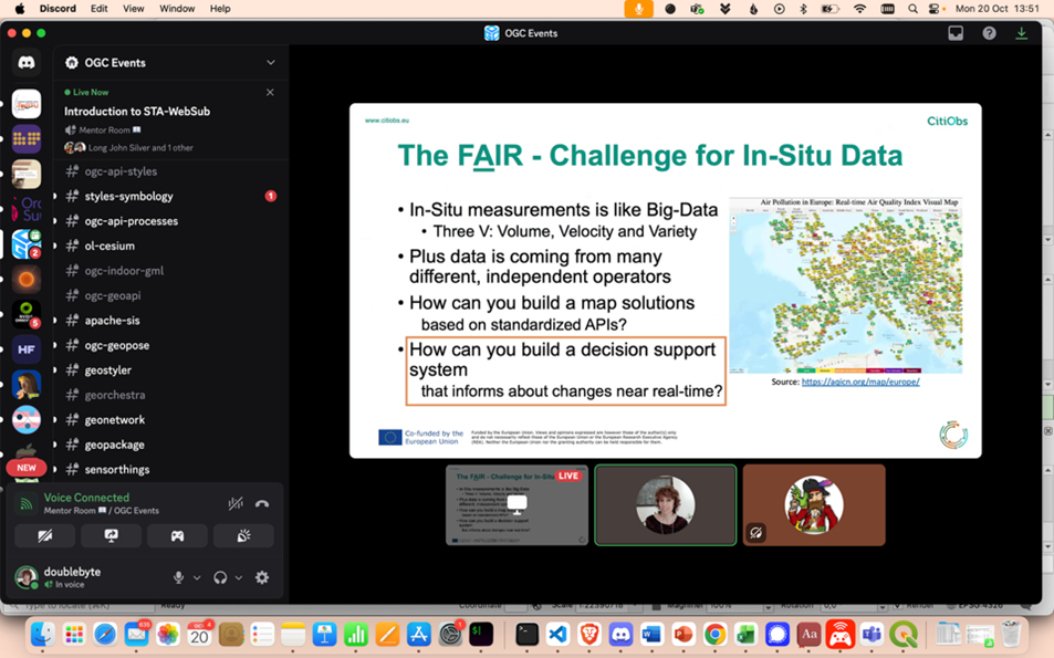
The second tutorial introduced the WebSub extension of SensorThings API. WebSub, a W3C Standard, is a protocol that enables real-time notifications of content updates. This approach is more efficient for clients than polling the server for updates, as it avoids the need to set a fixed interval and works for sensor data described by SensorThings API. The instructors demonstrated server and client implementations of STA- WebSub and even offered to set up a Raspberry PI collecting environmental data for anyone wishing to test the approach.
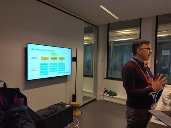
Next, there was a tutorial on the newest version of GeoNetwork (GeoNetwork 5), revealing its native support for OGC API – Records. GeoNetwork 5 supports Parts 1 and 2 of the Standard, including appealing functionalities such as faceted searches. The instructor provided a Docker composition that enabled launching GeoNetwork 5 and its dependencies as a set of microservices.
The following tutorial focused on OGC API – Joins. It started with a high-level description of the candidate Standard, followed by demonstrations of both server and client implementations. During this demonstration, the instructor performed joins on-the-fly between tables (in CSV format) and geospatial data (features).

The mentor stream concluded with an introduction to libCartoSym, a free and open source library that implements OGC Cartographic Symbology 2.0. The library facilitates transcoding between popular portrayal formats such as CartoSym-CSS, SLD, and Mapbox GL. One of the attendees, a QGIS developer, went on to collaborate with the instructor in the following days to improve support for symbology in QGIS.
Interestingly, we did not have many beginners at this Code Sprint. The tutorial instructors ended up attending each other’s tutorials, leading to valuable (though sometimes advanced) discussions. The complete list of tutorials, including summaries and relevant links, can be found here.
Main track activities
Developers who implemented the Standards, self-organized into smaller groups, where they worked closely with the SWG chairs, raising questions and sometimes flagging issues. A notable effort came from OS4CSAPI: Open Source for Connected Systems API, who were well-organized and provided daily written progress reports.
pygeoapi confirmed its role as a “playground” for implementing Standards, being forked twice during the sprint (for OGC API – Connected Systems and OGC API – Joins) and receiving a draft Pull Request for JSON-FG. It should be noted that these implementations are prototypes and may be merged upstream.
Another highlight was the increased awareness among software projects During the demo session, several implementations showcased integrations with other tools featured at the sprint. The ogc-checker linter, for example, was used by both ldproxy and pygeoapi to validate their JSON-FG outputs.
Most of the activities described above translated into GitHub activity. You can find links to the issues, Pull Requests, and commits originated by this code sprint on this GitHub issue.
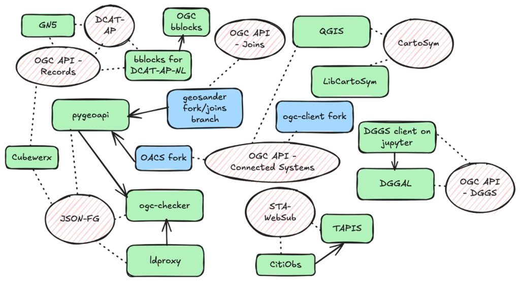
Standards and Software projects that took part of this sprint; the dotted arrows indicate which Standards the software projects implement, while the filled arrows indicate software projects that used other projects.
Final thoughts
This sprint confirmed the key role of Code Sprints in the Standards development process. This is often the moment when Standards are put into practice by different implementers, and many questions arise. Sometimes these questions can be clarified by the SWG chairs, and other times they lead to changes that (hopefully) will improve the Standard.
The sprint is also an opportunity to update implementations to the latest versions of the Standard and to perform interoperability experiments between clients and servers. Overall, it results in greater Standards uptake and improved interoperability.
We encourage everyone who has an interest in OGC Standards, no matter their degree of expertise, to attend these events and take part in this process.
The lessons learned during this sprint were compiled, collaboratively, on a GitHub issue.
You can track the announcements of future Code Sprints through the Code Sprints website. If you want to learn more about OGC Standards from a developer standpoint, check out the OGC Developer Website. If you want to chat, find us on the OGC-Events DiscordDiscord server.
Interested in joining our next event?
The OGC RAINBOW Sprint @ iDays 2025 will take place on 11 December 2025 at Dolce by Wyndham Bad Nauheim, in Hessen, Germany.
We invite developers, data experts, and geospatial practitioners to register and take part.
🔗 Registration & details: https://events.ogc.org/SprintOpenScienceOGCRAINBOWOGCAPIs
Disclaimer:
For the sake of simplicity in this post, the word “Standards” is used to refer to both approved and candidate Standards. You can check the status of a particular Standard on the OGC Standards Roadmap.